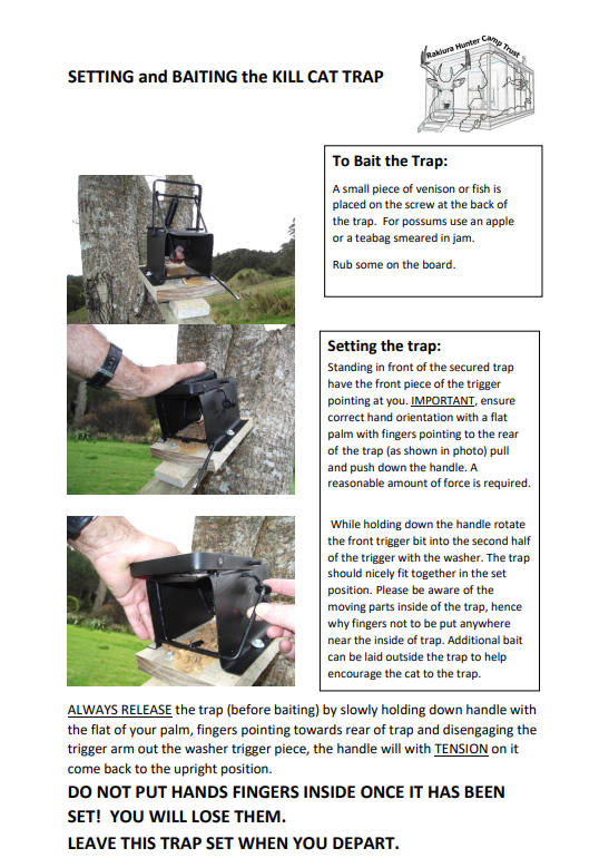
CAGE TRAPS. Hunter Huts also have a cage trap which can be used for cats or possums. It is vital that you unset the cage trap before you leave the hut to eliminate the risk of trapping a kiwi. Bait both traps with fish or meat for cats, use an apple or used Teabag covered in jam for possums.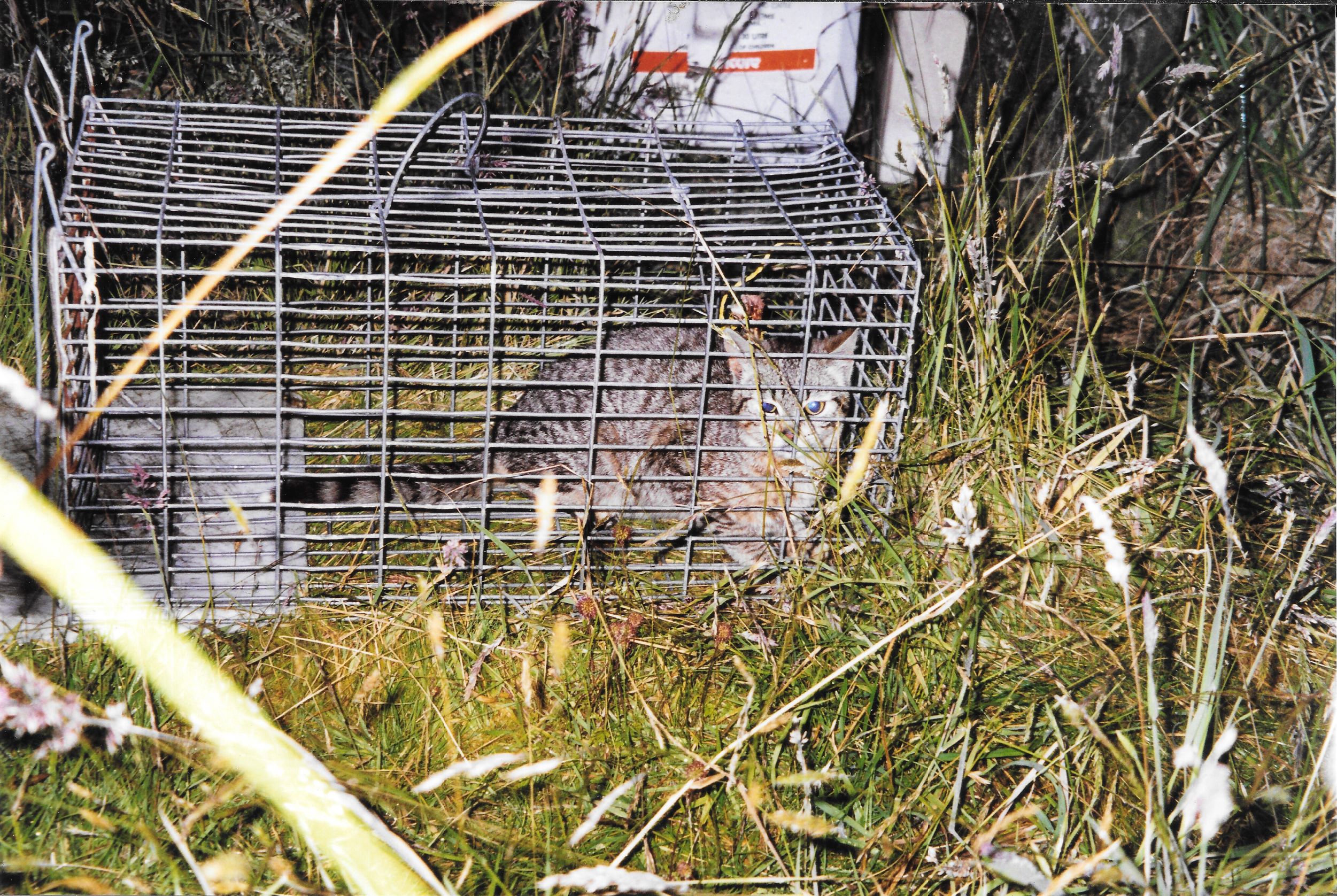
STEWART ISLAND HUNTER REPORTS
As hunters we can gather a large amount of information.
Collated this information can be a significant benefit to the management of hunting on the Island.
This information will allow hunters to be better represented once we know just what the hunter effort is achieving.
Reports on the condition of huts and campsites is also very helpful to enable the Hunter Hut Trust to stay up to date.
A summary of annual returns is available on HUNTER REPORT SUMMARY.
One of our supporters has overlayed some of the DOC Block maps so they can be either viewed in Google Earth, or uploaded to Garmin GPSmap series GPS'.
Note that the maps are about 95% accurate and placed over a 3D plane so some features may be ever so slightly offset. You should be able to turn the custom maps on or off from your GPS settings as required.
Below is the list in development.
3. Murray River
4. Rollers
6. Lucky
Save map to either (Garmin device drive) /Garmin/CustomMaps/ or (microSD Card drive) /Garmin/CustomMaps/
Note: It may be necessary for you to create a CustomMaps folder
For more information on
https://support.garmin.com/en-US/?faq=cVuMqGHWaM7wTFWMkPNLN9